


Reading the Thorncombe Landscape
By Tony Smith.
Thorncombe 2008
Introduction
This small book is designed to help those with an interest in the landscape around them come to a better understanding of how it came to be the way it is. There are few if any corners of the British Isles that have not been affected by human activity in one way or another and West Dorset is no exception. Each successive generation has made its mark on the landscape and in so doing has removed some of that which went before. Piecing together the evidence of what remains is detective work, some of which can be done in record offices and by combing the research findings of others but much has to be done in the field. A former professor of geography once said that the best fieldwork is done through the soles of your boots and that is the premise upon which this small book is based.
At the outset I would like to record a debt of gratitude to a number of eminent writers and researchers whose work I have become familiar with over the past four or five decades and whose writings I recommend to anyone with an interest in the subject. W.G. Hoskins, who did much of his work in the South West of England, is in many ways the father of Landscape History, his ground breaking book The Making of the English Landscape has been an inspiration to generations with an interest in the countryside. Christopher Taylor similarly has written extensively on the subject and again did a great deal of his early work in Dorset as an Inspector of Ancient Monuments. Taylor’s publications on Fields, Roads, Farms and Villages are invaluable, and his publication The Making of the Dorset Landscape, although written more than thirty years ago, is recommended reading for anyone with an interest in this part of the country. Oliver Rackham, an acknowledged authority on woodland, woodland history and the importance of woodland conservation, his recently republished The Illustrated History of the Countryside a mine of useful information accompanied by beautiful photographs, maps and line drawings. Richard Muir has done much to popularise the subject and his wonderful photographs point us in the right direction with regard to field observation. Several of the works of these authors, and many others, are acknowledged in the text and bibliography.
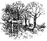
The different sections of this book are arranged thematically, suggested perambulations and sketch maps accompany each. The locations have been chosen to illustrate particular landscape features and because they retain significant evidence of what went before. All of the walks are confined to Public Rights of Way or to Permissive paths of one sort or another. Those who chose to follow some of these should keep to the country code and give careful thought to where they park vehicles should that be necessary.
The Parish
The parish of Thorncombe is situated on the western edge of the county of Dorset; prior to boundary changes in the 1840s it was the eastern most parish in Devon. While it would not be quite correct to describe the parish as isolated or remote, as would be the case for parishes on Dartmoor or perhaps some on the Dorset Chalk uplands, it is tucked away. No A road passes through the parish and only one B road for a short section on the eastern side. This peripheral location has had some influence on its Landscape development.
The parish comprises just under 5,500 acres and at the time of the 2001 census, had a population of 760. This is half of what it was at its most populous in the mid nineteenth centaury when it stood at 1425 (1841 census). Apart from the rationalisation of County boundaries mentioned above, the parish boundary has undergone only marginal changes during the nineteenth and early twentieth centuries. In the main, Thorncombe’s boundaries today are probably much as they were in pre Conquest times.
In many ways Thorncombe is an island. The rive Axe forms the boundary along the northern and western edges and the Blackwater and Synderford, both Axe tributaries, define the remainder . The only exception being a few hundred acres in the north east corner of the parish which are to the east of the Synderford river, the reasons for this anomaly are interesting and will be explored later.
As well as the main village, there are two hamlets within the parish, Hewood and Holditch, there have been others in the past .The only current industrial activity in the parish, other than agriculture and one or two small workshops , is on the extreme western edge. The Creamery (Milk Factory), the timber yard and the gravel extraction activities owe their origins, at least in part, to the coming of the railway in the 19thc. The London to Exeter line skirts the northern and western parish boundary and, until the Beeching closures of the 1960s, served the local communities with a station at Chard Junction.
Few of today’s inhabitants make their living in the parish; there are a substantial number of retired people and second homeowners. Apart from the farming community people commute to the neighbouring towns of Chard, Yeovil, Crewkerne, Axminster and Taunton for employment and a range of services.
Section 1
On The Rocks
Geography and Geology play an important part in shaping the landscape, they are what we first see and come to appreciate nevertheless it is generally accepted now that they are not quite the determining factors it was once fashionable to suggest. Clearly elevation, aspect, drainage and the underlying geology influence the way the land has been used and, to some extent, where settlements have been established, however many other factors are of equal if not greater importance, they will be the subject of later sections. None the less it makes sense to start with what lies beneath our feet and for which there is plenty of evidence.
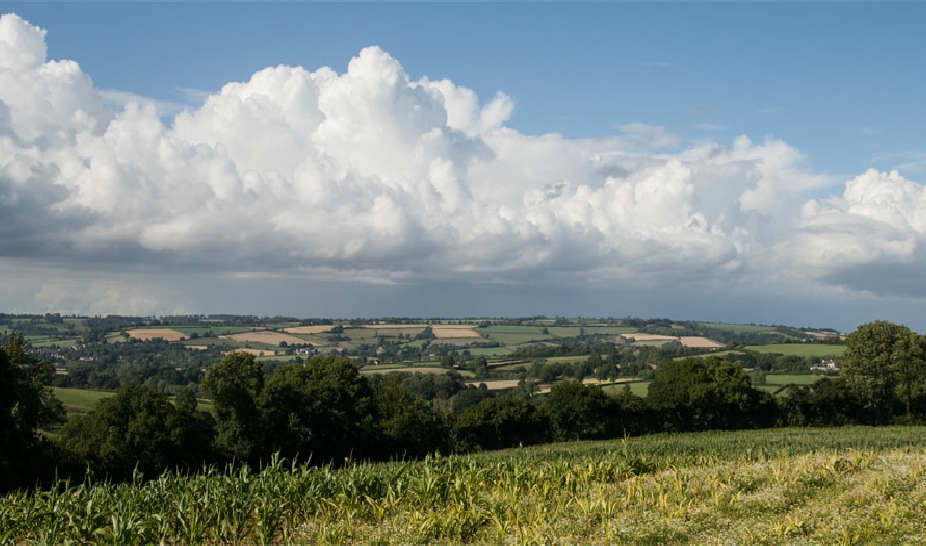
The geology of West Dorset is some of the most interesting and diverse in Southern Britain. The recent designation of the coastal section as a world heritage site emphasises the geological significance of the area. The magnificent cliffs, bays and headlands that attract millions of visitors every year provide an excellent glimpse into the geology history of the region. Inland the Cretaceous Chalk escarpment forms the eastern boundary of the region. Above and to the east of the escarpment, chalk Downs form a very distinct type of landscape. The Downlands, cut into by wide river valleys and deep combes, are graphically described in the novels of Thomas Hardy and the Poetry of William Barnes. To the west of the escarpment, an area which Kenneth Alsop once described as “Puckered and Chaotic” the rocks are of Jurassic age, the countryside is more varied, conical hills, wooded slopes, deep valleys and wide clay vales characterise inland West Dorset. Thorncombe occupies the western most corner of this landscape.
The underlying geology of the area is comprised of sedimentary rocks of Jurassic and Cretaceous age, formed 70 – 190 millions years before the present. The Jurassic rocks in particular are familiar to everyone who visits the nearby coast. The impressive cliffs, continuously eroded by the sea, provide fine sections through millions of years of geological history, fossils abound and landslips are common.
Within the Jurassic rocks there are great variations, ranging from heavy clays and marls to fine sands and Limestones The Jurassic Limestones elsewhere in the county, provide some of the country’s best building materials, The Portland and Purbeck Limestones being two examples. Hamstone, another Jurassic deposit, while not outcropping in the parish but found close by, has been used widely in some substantial buildings in the parish.
Unfortunately inland few exposed sections exist, however a little knowledge of the characteristics of the various rocks in the area helps us to understand the basic topography – the ups and downs of the land – the drainage patterns that have influenced land use, communications and settlement. A visit to the nearby coast between Bridport and Lyme Regis, and in particular the Heritage centre at Charmouth, would be a good place to start. One of the high points along this section of coast is interestingly called Thorncombe Beacon and one of the beds within the Jurassic sequence, outcropping in the area, is know as the Thorncombe Sands.
Beneath our feet.
The underlying geology of the Parish of Thorncombe is relatively straightforward . All of the rocks are sedimentary in character, that is, formed in layers once below the sea, made up of materials deposited on the sea floor. All are of either Jurassic or Cretaceous age. The strata, (beds of rock) still rest almost horizontally much as they were when deposited. Earth movement that have elsewhere crumpled the beds into folds (Lulworth Cove provides some dramatic examples) have not significantly affected this area. The gentle dip (slope) of the rocks towards the north and east, subsequently affected by minor faulting, has had some influence on landform development in the area (see below).
The Cretaceous chalk, the youngest rock in the parish (excluding the superficial deposits, see below), forms the highest ground towards the centre of the parish. A small patch of Chalk is surrounded by older Greensand. This is known in geological terms as an outlier. The older Jurassic Sandstones and Oolites (Limestones) outcrop on the valley sides while the lias clays are generally found on the valley bottoms.. Unfortunately for the geologist, much of the parish is blanketed with superficial deposits, Clay with flints and Chert, Alluvium (river deposits) and thick deposits of gravel, making it impossible to actually see the solid geology, the bedrock. In one or two places human activity has excavated down to the underlying rocks but these tend to be little more than overgrown hollows in fields or patches of woodland.
The Clay with flints which blanket the surface in varying thicknesses across the parish are what remains of millions of year of weathering of older rocks. These superficial deposits have, under the influence of water; wind; and ice moved down the slopes, consequently they often have little relationship to the rock below. The Alluvium on the valley floors has been deposited by rivers and in some places forms quite extensive plains and terraces of level ground – still subject to flooding and further deposition. The gravel deposits, which are extensive and of considerable thickness in the western part of the parish, have been formed either by higher river and sea levels in the past or deposited by ice moving along the valleys during colder periods. The latter is the subject of some debate and needs further research. The gravel deposits, which extend as terraces down much of the Axe valley, have been exploited commercially for many years. At the time of writing a permissive path is being opened around some of the worked out pits at Broadbridge, this will provide visitors with an ideal opportunity to view sections through the gravel deposits as well as an opportunity to observe some of the wild life for which these pits have become a haven.
While the Clay with flints, to a great extent, masks what lies below, the solid geology
has had an important affect on the topography, the high ground generally being that
which has most effectively resisted weathering and erosion and that through which
water can more readily pass, the low being that which is more vulnerable and which
tends to impede the water’s progress, the clays are a good example. One important
influence the solid geology has had has been the distribution of springs and streams,
influencing where water has been most readily accessible or where bore holes have
been able to tap into aquifers -
Tony Smith
Thorncombe 2008

| History of the Trust |
| Constitution of the Trust |
| Minutes of meetings |
| Archived Minutes |
| Obituaries |
| Contacts |
| Newsletter |
| Newsletter Archives |
| Past Events |
| Blackdown Walk Aug 2013 |
| Bluebell Walk May 2013 |
| Pollinator Survey June 2013 |
| Visiting new-born lambs 2013 |
| 2014 Christmas Sale |
| Trees |
| Commemorative Trees |
| Johnson's Wood |
| Geology and geography |
| Wildlife |
| Birds |
| Chard Junction Nature Reserve |
| Nature Reserve pictures |
| Butterflies |
| Butterfly surveys |
| Photo albums |
| Artists and writers |
| Footpaths |
| General |
| Poor relief |
| Houses |
| In the news |
| Industry |
| Pubs |
| Religion |
| Reminiscences |
| Schools |
| 17th and 18th centuries |
| Harry Banks |
| Pissarro |
| Hedge Dating |
| Once upon a Thorncombe Road |
| Thorncombe's Lost Roads & Hidden Holways |
| Thorncombe's History |
| First World War Thorncombe men |
| Thorncombe's Changing Boundaries |
| Parish Poorhouse and Workhouses |
| The poor |
| Life in Thorncombe's Workhouse |
| Chard St Bakery & Forge |
| Holway Cottage |
| Forde Abbey |
| Gough's Barton |
| Holditch Court |
| Upperfold House |
| Sadborow Hall |
| Wayside |
| Thomas Place and The Terrace |
| Pinneys |
| 1 & 2 Church View Chard Street |
| Dodgy local ice-cream |
| Gribb arsenic poisoning |
| Industrial relics |
| Westford Mill |
| Thorncombe's Flax and Hemp Industries |
| Broomstick Weddings |
| Royal Oak |
| Golden House |
| St Mary's Church |
| Thorncombe's West Gallery Choir |
| Thorncombe's Chapels |
| Quakers |
| Commonwealth vicars |
| Who was William Bragge? |
| Holditch memories |
| St Mary's School |
| St Mary's School photos |
| Forgotten epidemic |
| Jacobites |
| Walk 1 |
| Walk 2 |
| Walk 3 |
| Walk 4 |
| Walk 5 |
| Walk 6 |
| Walk 7 |
| Walk 8 |
| A Village Walk. Walk 9 |
| Walk 10 |
| Rights of Way information |